


new
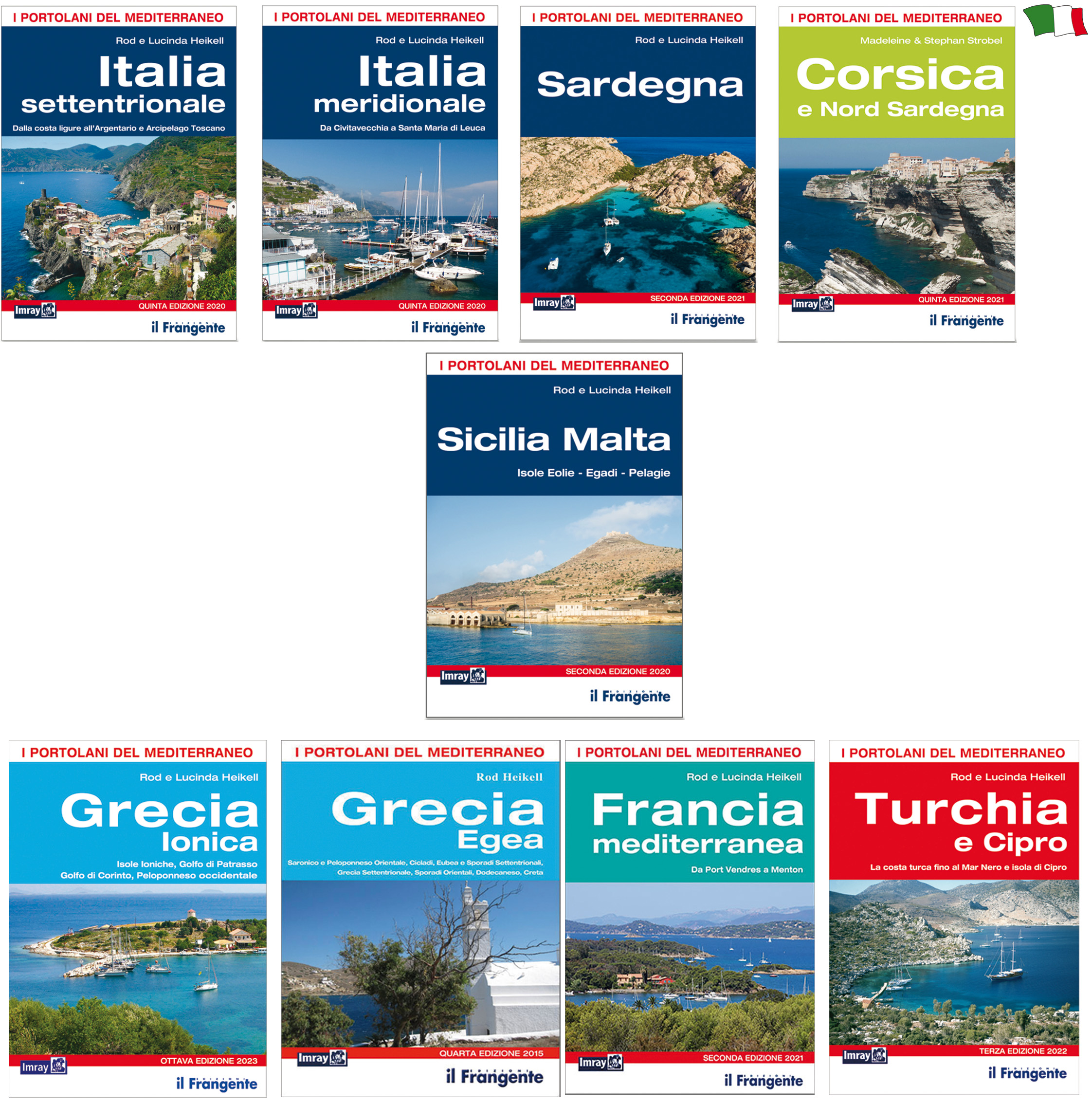
The pilot books published by "Il Frangente" are the italian version of the English books Imray Laurie Norie and Wilson for the Mediterranean area.
For each zone they describe the coasts and islands with the correspondant harbors, marinas and anchorages, including short texts and the related symbols indicating the services available on the ground and in the port structure. In a single glance the skipper will be able to have all the necessary information about your destination and the near stretch of sea: shape of the coastline, depth, light signals, channels and passages, useful telephone numbers, boundaries of marine reserves, GPS waypoints.
Paperback volumes bound in A4 format colour illustrated pages.
| | Zone | Harbours and Anchorages | N° nautic plans |
|---|---|---|---|
| NORTH ITALY | From the Ligurian coast to Argentario and the Tuscan Archipelago | 121 | |
| SOUTH ITALY | From Civitavecchia To Santa Maria di Leuca | 129 | |
| SARDINIA | - | 108 | |
| CORSE - NORTH SARDINIA | - | 161 | |
| SICILY - MALTA | Sicily and Egadi Islands - Aeolian Islands - Pelagian Islands and Malta | 110 | |
| AEGEAN GREECE | From Saronic and Peloponnese Oriental Cyclades - Eubea and North Sporades islands Northern Greece, Eastern Sporades - Dodecanese - Crete | 453 | |
| IONIAN GREECE | From Ionian Islands - Gulf of Patras - Gulf of Corinth - Western Peloponnese | 168 | |
| MEDITERRANEAN FRANCE | From Port Vendres a Menton | 201 | |
| TURKEY AND CYPRUS | From the Turkish coast to the Black Sea to the Syrian-Cypriot border | 401 |


Share